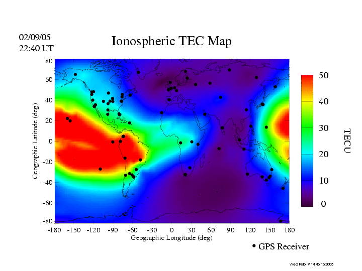
Global maps of ionospheric total electron content (TEC) are
produced in real-time (RT) by mapping GPS observables collected from ground
stations. These maps are produced to test real-time data acquisition, monitoring
facilities, and mapping techniques. The RT TEC mapping can provide accurate
ionospheric calibrations to navigation systems.
These maps are also used to monitor ionospheric weather, and
to nowcast ionospheric storms that often occur responding to
activities in solar wind and Earth's magnetosphere as well as thermosphere.
